




























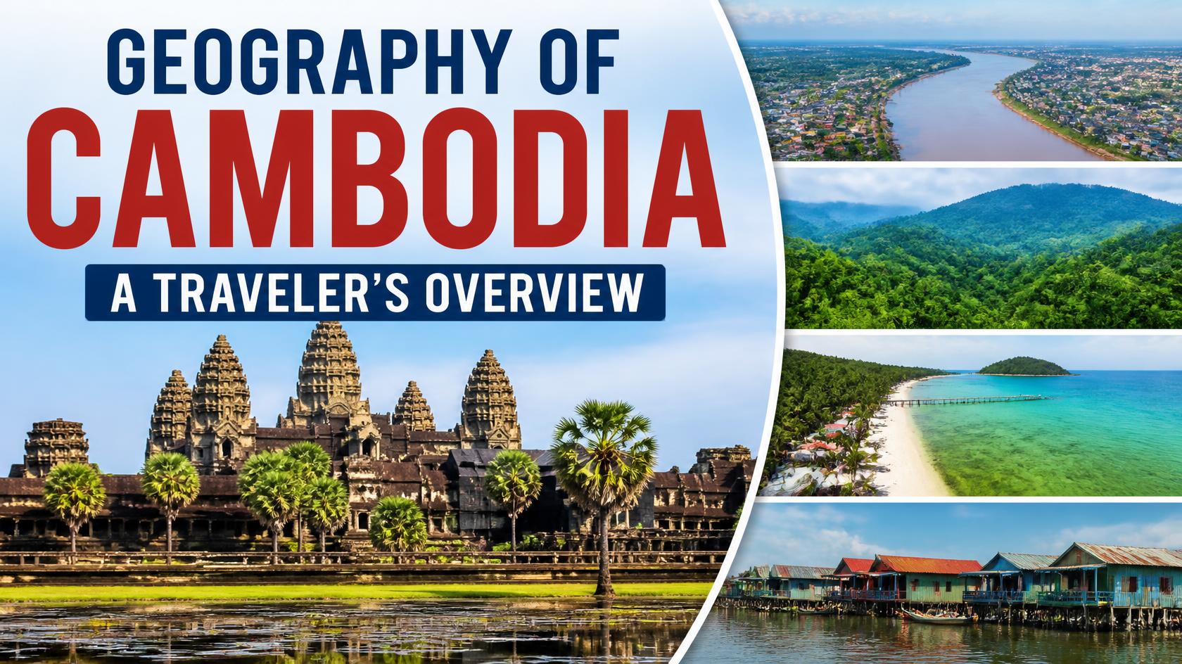

Cambodia may look relatively small on a map, but its geography is surprisingly diverse. From the vast plains surrounding the Mekong River and Tonle Sap Lake to forested mountains, tropical islands, rice fields, and a long southwestern coastline, the country’s landscapes offer very different experiences for travelers.
Understanding the geography of Cambodia can make planning a trip much easier. The location of a province often tells you something about its scenery, climate, transportation options, agricultural traditions, and the kinds of experiences you can expect to find there.
Cambodia is located in mainland Southeast Asia and shares international borders with Thailand, Laos, and Vietnam. To the southwest, the country faces the Gulf of Thailand. Administratively, Cambodia has 25 provinces, including Phnom Penh as the capital-level municipality in the national statistical framework.
Where Is Cambodia?
Cambodia is situated in the southern part of mainland Southeast Asia, between Thailand, Laos, and Vietnam. Its central position in the region has historically connected it with neighboring countries through rivers, trade routes, migration, and cultural exchange.
The country has a relatively compact shape, which makes several major destinations accessible by road from Phnom Penh or from neighboring tourist centers. However, travel times can vary significantly depending on road conditions, the season, the destination, and whether you are traveling to remote northeastern or southwestern areas.
Cambodia’s geography can broadly be understood through four major zones:
- The Plains Zone — the central lowlands around the Mekong and other major waterways.
- The Tonle Sap Lake Zone — a region shaped by Cambodia’s enormous freshwater lake and surrounding lowlands.
- The Plateau and Mountainous Zone — the forested and elevated areas of the northeast and north.
- The Coastal Zone — the southwestern region along the Gulf of Thailand, including beaches, islands, mangroves, and coastal forests.
This four-zone classification is used by Cambodia’s National Institute of Statistics in its agricultural and geographic surveys.
The Central Plains: The Heart of Cambodia
The central plains form the geographic core of Cambodia. This relatively low-lying landscape includes extensive agricultural areas, villages, waterways, and some of the country’s most densely populated areas.
The Plains Zone includes Kampong Cham, Kandal, Phnom Penh, Prey Veng, Svay Rieng, Takeo, and Tboung Khmum.
The Mekong River is particularly important here. It provides water for agriculture, supports fisheries and transportation, and connects communities across Cambodia and neighboring countries.
Phnom Penh is located in this central region at an important river junction. The capital developed around the meeting of major waterways, including the Mekong, Tonle Sap, and Bassac systems, making geography a major factor in the city’s historical and economic importance.
Why the Central Plains Matter to Travelers
Travelers passing through the central plains will see a landscape strongly connected to everyday Cambodian life. Rice fields, agricultural communities, local markets, riverside settlements, temples, and growing towns are common features.
This region is especially useful for travelers interested in seeing Cambodia beyond its most famous tourist destinations. Kampong Cham, for example, offers riverside scenery and rural landscapes, while Takeo and surrounding areas provide access to historic sites and countryside experiences.
Tonle Sap Lake: Cambodia’s Great Inland Waterway
Tonle Sap is one of the defining geographic features of Cambodia. It is the country’s largest lake and is closely connected to the Tonle Sap River and the Mekong system.
The lake’s remarkable seasonal changes influence fishing, agriculture, transportation, wildlife, and settlement patterns. During the wet season, increased water flows cause the lake to expand dramatically, while water levels fall during the dry season.
The Tonle Sap Lake Zone includes Banteay Meanchey, Battambang, Pailin, Siem Reap, Oddar Meanchey, Kampong Thom, Kampong Chhnang, and Pursat in the National Institute of Statistics’ geographic classification.
Not all of these provinces physically surround the lake. Some, such as Pailin and Oddar Meanchey, are included in the zone for historical and administrative reasons.
Why Tonle Sap Matters for Travel
Tonle Sap provides some of Cambodia’s most distinctive travel experiences. Visitors can explore floating and lakeside communities, observe fishing lifestyles, take boat trips, and discover ecosystems that are closely connected to seasonal changes in water levels.
Siem Reap is the main gateway for many visitors exploring the Tonle Sap area. From there, travelers can combine Angkor with excursions to nearby lake communities and countryside.
The Mekong River and Cambodia’s Water Geography
The Mekong is one of the world’s great rivers and a central geographic feature of Cambodia. It enters Cambodia from the northeast, flows through the country, passes Phnom Penh, and continues toward Vietnam.
The river system supports fisheries, agriculture, transportation, wetlands, and communities. Several Cambodian cities and towns developed along or near major waterways because rivers historically provided transportation, food, water, and opportunities for trade.
The Mekong also connects Cambodia geographically with a much larger regional system extending through China and mainland Southeast Asia.
The Mountains and Plateaus of Cambodia
Although Cambodia is often associated with flat rice fields, the country also contains extensive mountains, hills, forests, and plateaus.
The Plateau and Mountainous Zone includes Kampong Speu, Preah Vihear, Ratanak Kiri, Mondul Kiri, Kratie, and Stung Treng.
The northeast is particularly important for travelers seeking a different side of Cambodia. Mondulkiri and Ratanakiri are known for forest landscapes, rolling hills, waterfalls, Indigenous communities, and more remote travel experiences.
Mondulkiri
Mondulkiri is one of Cambodia’s most distinctive highland destinations. Its elevated terrain, forests, grasslands, waterfalls, and cooler-feeling landscape make it very different from the central plains.
The provincial capital, Sen Monorom, is a useful base for exploring the surrounding countryside and natural attractions.
Ratanakiri
Ratanakiri lies in Cambodia’s far northeast and is known for red-earth landscapes, forests, lakes, waterfalls, and Indigenous cultural communities.
Banlung is the main urban center and a common starting point for exploring the province.
Preah Vihear
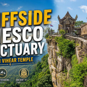
Preah Vihear Province combines mountains, forests, rural landscapes, and important archaeological heritage. The province is home to the famous Preah Vihear Temple, dramatically positioned on a mountain ridge near the Thai border.
Its geography demonstrates how Cambodia’s natural landscape and ancient Khmer heritage are often closely connected.
Cambodia’s Coastal Region
Cambodia’s southwestern coast faces the Gulf of Thailand. The Coastal Zone consists of Kampot, Koh Kong, Preah Sihanouk, and Kep.
This region contains a mixture of beaches, islands, mangrove ecosystems, coastal forests, fishing communities, rivers, and mountains.
Kampot
Kampot sits near the coast along the Kampot River and is surrounded by countryside and mountains. It is particularly popular with travelers interested in relaxed riverside stays, food, pepper farms, caves, and access to Bokor National Park.
Kep
Kep is a small coastal destination known for its seaside atmosphere, seafood, nearby islands, and access to Kep National Park. Its compact geography makes it easy to combine with Kampot.
Preah Sihanouk
Preah Sihanouk Province is Cambodia’s major coastal tourism and maritime gateway region. The province includes mainland beaches as well as access to several islands, making it one of the country’s main destinations for beach holidays.
Koh Kong
Koh Kong is located in the southwest near the Thai border and contains some of Cambodia’s most extensive remaining coastal and forest landscapes. The province is particularly interesting for travelers interested in nature, rivers, mangroves, waterfalls, and less-developed coastal areas.
Cambodia’s 25 Provinces
For travelers, understanding the provinces is useful because many Cambodian destinations are identified by province rather than only by city. Cambodia’s current national statistical geography recognizes 25 provinces/municipal-level jurisdictions.
Central and Southeastern Cambodia
- Phnom Penh — The capital and country’s major urban, political, commercial, and cultural center.
- Kandal — Surrounds much of Phnom Penh and is closely connected to the capital’s economy.
- Kampong Cham — A Mekong-side province known for rural landscapes, agriculture, and cultural heritage.
- Tboung Khmum — Located east of the Mekong and known for agriculture, rubber plantations, and rural communities.
- Prey Veng — A largely agricultural province in the southeastern plains.
- Svay Rieng — Located along the route toward Vietnam and important for cross-border trade and agriculture.
- Takeo — A southern province with ancient archaeological sites, rice-growing areas, and waterways.
Northwestern Cambodia and the Tonle Sap Region
- Siem Reap — Home to Angkor and one of Cambodia’s most important tourism centers.
- Battambang — Known for colonial architecture, arts, agriculture, countryside, and historic sites.
- Pursat — A province stretching from the Tonle Sap area toward the Cardamom region.
- Kampong Chhnang — Known for pottery traditions, river and lake environments, and rural landscapes.
- Kampong Thom — Centrally located and home to important archaeological heritage including Sambor Prei Kuk.
- Banteay Meanchey — A northwestern province bordering Thailand and an important transport and trade area.
- Oddar Meanchey — A northern province with forests, rural landscapes, and archaeological heritage.
- Pailin — A small western province near Thailand, historically associated with gem mining and surrounded by hilly landscapes.
Northeastern Cambodia
- Kratie — Famous for Mekong landscapes and opportunities to see Irrawaddy dolphins.
- Stung Treng — A northeastern province where major rivers and forest landscapes create important ecological areas.
- Ratanakiri — Known for red soil, forests, waterfalls, lakes, and Indigenous communities.
- Mondulkiri — A highland province known for forests, rolling hills, waterfalls, and nature-based tourism.
- Preah Vihear — Known for mountainous landscapes and the spectacular Preah Vihear Temple.
Southern and Southwestern Cambodia
- Kampot — A riverside and coastal province popular for pepper, countryside, caves, and Bokor.
- Kep — A compact coastal province known for seafood, beaches, islands, and national park landscapes.
- Preah Sihanouk — Cambodia’s major coastal tourism province and gateway to several islands.
- Koh Kong — A southwestern province with extensive forests, rivers, mangroves, and coastal ecosystems.
- Kampong Speu — A province west of Phnom Penh extending toward mountainous areas and the Cardamom landscape.
Mountains, Forests, and Protected Landscapes
Cambodia’s mountainous areas are especially important for biodiversity. Forested landscapes in the Cardamom Mountains, southwestern Cambodia, and the northeastern highlands provide habitats for many species and support rivers and watersheds.
For travelers, these landscapes offer opportunities for hiking, wildlife experiences, waterfalls, eco-tourism, camping, and community-based tourism.
However, natural areas can be remote. Visitors should plan transportation carefully, use experienced local guides where appropriate, and follow local conservation and park regulations.
Why Geography Matters for Cambodian Travel
Cambodia’s geography directly affects the type of journey you can have.
- Want ancient temples? Head toward Siem Reap, Preah Vihear, Kampong Thom, and other heritage areas.
- Want rivers and rural landscapes? Explore the Mekong provinces and Tonle Sap region.
- Want beaches and islands? Travel to the southwestern coast and islands around Preah Sihanouk.
- Want mountains and forests? Consider Mondulkiri, Ratanakiri, Koh Kong, Kampong Speu, or other highland areas.
- Want city life? Phnom Penh is the country’s main urban center.
- Want countryside and local life? Many provinces outside the main tourist hubs offer agricultural landscapes and village experiences.
One of the best ways to experience Cambodia is to combine different geographic environments rather than staying in only one part of the country.
Geography and Cambodia’s Climate
Cambodia has a tropical monsoon climate, with seasonal changes that strongly affect its landscapes and travel conditions. The rainy season generally brings greener countryside, fuller rivers and waterfalls, and more water in the Tonle Sap system. The dry season generally offers easier road conditions and more predictable weather for many outdoor activities.
However, conditions vary by region. Mountainous areas can feel cooler than the lowlands, while the coast experiences its own combination of rainfall, humidity, and sea conditions.
Understanding the relationship between geography and seasons is particularly useful when planning trips involving rural roads, hiking, waterfalls, islands, or remote provinces.
How Cambodia’s Geography Shaped Its History
Geography has played an important role in Cambodian history. The fertile central plains and extensive waterways supported agriculture and population growth, while the Mekong and Tonle Sap systems provided food, transportation, and connections between communities.
The landscape also influenced the development of the Khmer Empire. The Angkor region benefited from sophisticated water-management systems that helped support a large urban and agricultural landscape.
Mountains and forests provided natural resources and shaped movement between different regions, while Cambodia’s position between Thailand, Laos, and Vietnam contributed to centuries of regional interaction.
Today, these same geographic features continue to influence agriculture, tourism, transportation, settlement, and economic development.
Frequently Asked Questions
How many provinces are there in Cambodia?
Cambodia has 25 provinces in its national statistical and administrative geographic framework, with Phnom Penh treated as the capital-level municipality. The National Institute of Statistics lists all 25 provincial/municipal jurisdictions in its recent agricultural and population datasets.
What are the main geographic regions of Cambodia?
Cambodia is commonly divided into four major geographic zones: the Plains Zone, Tonle Sap Lake Zone, Plateau and Mountainous Zone, and Coastal Zone.
Does Cambodia have mountains?
Yes. Cambodia has several mountainous and highland areas, including the Cardamom Mountains in the southwest and highland landscapes in Mondulkiri and Ratanakiri in the northeast.
What is the largest lake in Cambodia?
Tonle Sap is Cambodia’s largest lake and one of the most important geographic features in the country. Its seasonal changes influence fisheries, agriculture, transportation, and communities.
What countries border Cambodia?
Cambodia shares land borders with Thailand, Laos, and Vietnam. Its southwestern coast faces the Gulf of Thailand.
Which part of Cambodia is best for nature?
It depends on the type of nature you want to experience. Mondulkiri and Ratanakiri are excellent choices for highlands and forests, Koh Kong for coastal and forest ecosystems, the Tonle Sap region for freshwater landscapes, and the southern coast for beaches and islands.
Which Cambodian provinces are best for first-time travelers?
For a first visit, many travelers begin with Siem Reap, Phnom Penh, Battambang, Kampot, Kep, and Preah Sihanouk. These destinations provide a useful mix of history, cities, countryside, food, rivers, mountains, beaches, and islands.
Sources & References
- National Institute of Statistics of Cambodia — Cambodia Agriculture Census 2023: Main Report
- National Institute of Statistics of Cambodia — General Population Census of Cambodia 2019
- National Institute of Statistics of Cambodia — Cambodia Agriculture Survey 2023
- National Institute of Statistics of Cambodia — Statistical Yearbook of Cambodia
Conclusion: Discover Cambodia Through Its Geography
Cambodia’s geography is one of the keys to understanding the country. The central plains connect communities through the Mekong, Tonle Sap links water, fisheries, and agriculture, mountains and forests shelter remarkable natural landscapes, and the southwest opens onto beaches and tropical islands.
For travelers, geography is more than a map. It helps explain why different parts of Cambodia look, feel, and live differently. A journey from Phnom Penh to Siem Reap, from the Mekong to Mondulkiri, or from the temples to the southern coast can reveal several very different sides of the same country.
Ready to explore Cambodia? Continue with GoToKH’s destination guides to discover the country’s provinces, cities, islands, mountains, rivers, ancient temples, and hidden gems.
